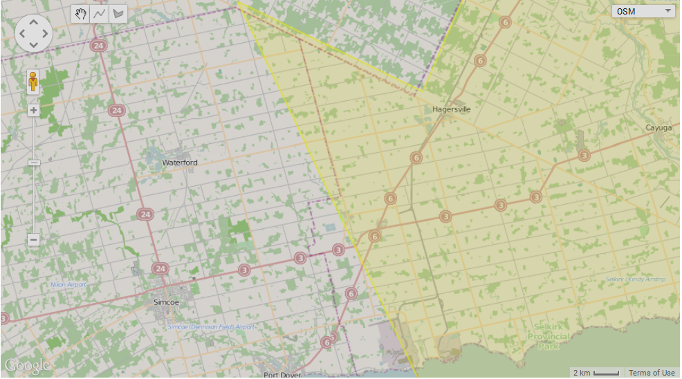
In the image below you can see in yellow the border of Haldimand county as it is currently known by GSAK.
![user posted image]()
As you can see, the border with Norfolk county is a straight line and does not follow the county border as it is available in OpenStreetMap.
Based on this image it is clear why some caches are tagged with the wrong county name.
The counties are in Ontario, Canada, and as far as I can see the polygons for Ontario were made by ky.m.guy
So let's see what he thinks of this.